The ‘Seven’ Access Routes
Over the course of its medieval development, Piazza dei Cavalieri was known by various names before it became the seat of the knights (cavalieri) of the Order of Saint Stephen. In the fifteenth century, it was called Piazza del Capitano, after the magistracy that continued to occupy the site under Florentine rule. Earlier, in the thirteenth and fourteenth centuries, sources refer to it as Piazza del Popolo, Piazza degli Anziani. These two names reflect its role as a political centre established by the government of the Popolo. Although, as illustrated by Marco Ronzani, the toponym ‘delle sette vie’ does not seem to have been used in medieval documentary sources in conjuction with the term ‘platea’ (piazza), this additional denomination for the area calls for some explanation. The name refers to the convergence of seven streets (vie), now reduced to five. An early sixteenth-century plan of Pisa, attributed to Giuliano da Sangallo, appears to confirm the toponym, although its reliability is uncertain. Ewa Karwacka interprets it as follows: ‘The streets marked on the plan are: Via del Monte Pio (now Via U. Dini), a street on the site of the present-day headquarters of the Public Works office [Palazzo della Canonica], Via San Frediano, a street between the buildings adjoining the Collegio Puteano and the Palazzo del Consiglio dei Dodici (formerly Palazzo dei Priori), Via San Rocco (later Via Corsica), Via della Faggiola, and Via del Nicchio (later Via Consoli del Mare), which at that time opened onto the piazza between the Palazzo degli Anziani and the torre della muda.’ Seven streets, indeed, though they are difficult to discern on the plan, which does not permit a clear or unambiguous reading.
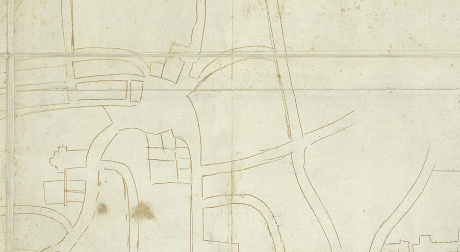
Excavations carried out in the piazza (1993; 2011–2013), and within Palazzo della Canonica (2021-2022) provide tangible evidence of medieval thoroughfares that have since disappeared. On the basis of excavation data and documentary sources, at least three major streets can be identified among the ‘seven streets’, each named after a neighbouring church: to the west, the via di San Sisto (now Via Corsica); to the south, the via or ‘carraja’ di San Frediano; and to the east, the via di San Felice (now Via Ulisse Dini), which led towards the Borgo.
These routes connected the new seat of the popular Commune in the piazza with older centres of civic authority. The first was the church of San Sisto, founded by the same families who had played a central role in Pisa’s earliest communal government. It hosted citizens’ assemblies led by the consuls and, between the twelfth and fourteenth centuries, the judicial courts. The second was the church of San Frediano, a judicial seat in the twelfth century, situated along the Arno, alongside the early marquisal centre of San Nicola. The third was the communal hub between the churches of Sant’Ambrogio and San Felice, where the first domus communis was established in 1161. This later became the seat of the Podestà and his entourage, of the civil curie, and their relative archives.
The identification of a fourth access to Piazza del Popolo, linked to the so-called via di San Sebastiano (or ‘Sancto Bastiano’), remains uncertain. It is mentioned in the vivid account of Count Ugolino’s final urban battle in the Fragmenta historiae pisanae: ‘Both sides engaged in battle; the bell of the Commune rang for the Archbishop’s faction, and the bell of the Popolo for Count Ugolino’s. The fighting was fierce, on horseback and on foot, from towers and houses, along the carraja from one courtyard and palace to another, along the carraja di San Frediano, the via di San Sebastiano, and other streets […] until Count Ugolino’s side was defeated and his men took refuge in the Palazzo del Popolo.’[‘E funno a la battaglia l’una parte, e l’altra; e sonnò la Campana del Comuno da la parte de l’Arcivescovo, e la Campana del Populo da la parte del Conte Ugolino. E fu la battaglia grande a cavallo e a piè, e di su le Torre e de le Case per la Carraja da l’una Corte e Palazzo a l’altro, e per la Carraja di Sancto Frediano, e per la via di Sancto Bastiano, e per l’altre vie […] e a la fine la parte del Conte Ugolino perdette; e rinchiusensi in del Palazzo del Populo tutta la sua giente’]
It remains unclear whether the via di San Sebastiano ran along the façade of the church, coinciding with the via di San Felice, or along the flank of the church of the same name, corresponding to today’s Via Consoli del Mare. The latter appears more likely, based on the reconstruction of the medieval location of San Sebastiano proposed by Francesca Anichini and Gabriele Gattiglia in 2007, although the available sources do not definitively resolve the question.
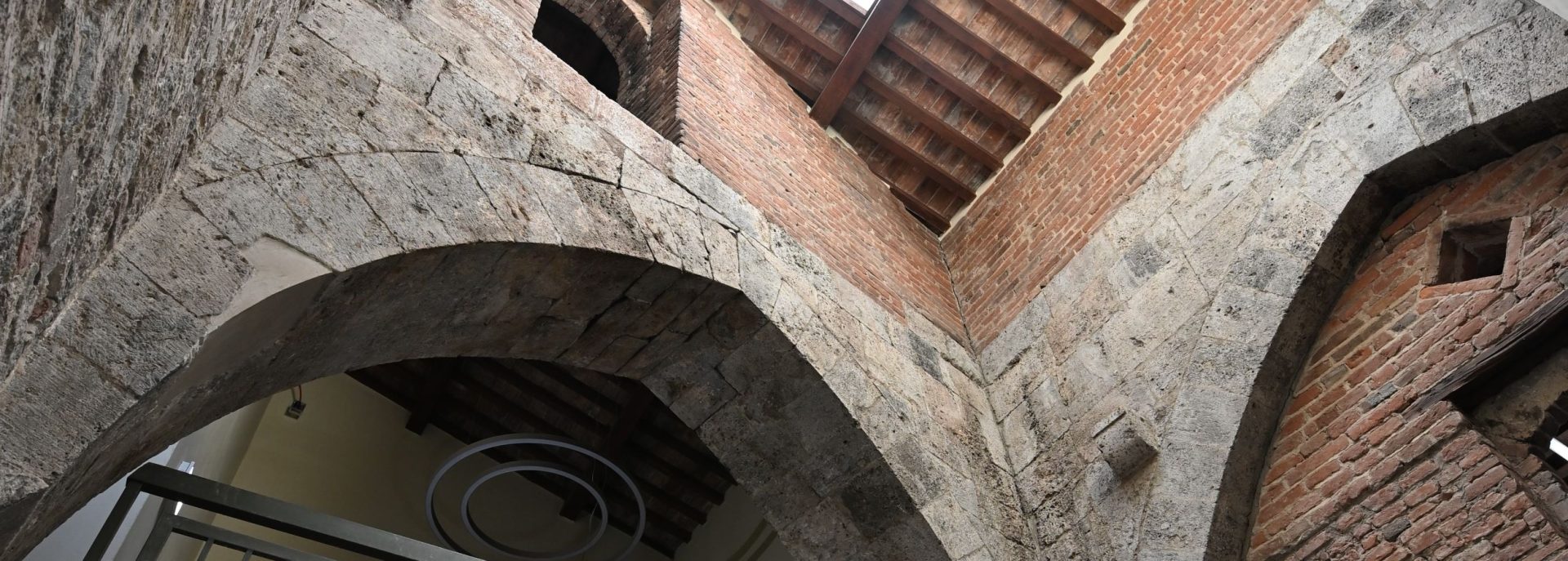
As for the other three accesses to the piazza—near the Tower of Famine, Palazzo dei Dodici, and cutting through the block of the present-day Palazzo della Canonica—the far scarcer documentary evidence suggests that they were not major thoroughfares. Rather, they were narrower, secondary routes, part of the local minor street network that remained in use until Giorgio Vasari remodelled the piazza.
Emilio Tolaini has commented on the numerical and symbolic significance of the toponym ‘Sette Vie’, noting the recurrence of the number seven in place names in the city centre between the Borgo and what would later become Piazza dei Cavalieri—via delle Sette Volte, Sette Colonne, Sette Corti o Curie. He also suggests a possible origin in 962, when, according to the chronicle of Ranieri Sardo, Emperor Otto I came to Pisa with seven barons, from whom seven noble Pisan families were said to have descended.
The role of the access routes within the circulation system of Piazza del Popolo remains unclear. The medieval urban area was probably much smaller, with correspondingly narrower approaches that were easier to control. Spontaneous movement through the piazza cannot be taken for granted: written sources describe mechanisms such as chains used to close it off at night or in times of particular danger for the communal magistracies.
This was the case during the insurrection of 1335 against Count Fazio da Donoratico, recounted in the Cronica di Pisapreserved in the Roncioni manuscript: ‘When the tumult broke out, many citizens rallied to defend Count Fazio and gathered in Piazza degli Anziani. Messer Benedetto and his faction tried to enter the piazza but found the chains drawn and were denied access. They then took the via di San Sisto to reach the same piazza, but were again blocked by the chains’ [‘E levato lo romore molti citadini preseno a difender lo conte Fatio, e cola sua parte venne in sulla piassa delli Ansiani, e lo ditto messer Benedetto colla sua parte volseno entrare in sulla piassa, trovonno le catene tirate e non potetteno entrare, che ffu loro contraditta l’entrata. Alora tenneno per la via di Santo Sisto per montare in sulla piassa delli Ansiani preditta, e non poténo per le ditte chatene’]
Unable to break into the piazza, the rebels instead fought along the via di San Sisto and, according to the anonymous chronicler, provoked an escape from the communal prison and set fire to the records of the curia maleficiorum, the Commune’s criminal court.
The expression ‘catene tirate’ remains ambiguous and may perhaps be explained by the presence of gates at the entrances to the piazza, closed with chains—a tangible sign of communal authority over a space that was ‘selectively public’.
Media gallery


Newsletter
Stay in Touch
Sign up for the Piazza dei Cavalieri newsletter
to receive updates on project progress and news.